
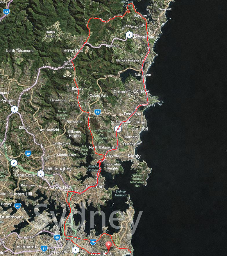
The eastern suburbs to McCarrs Creek return journey covers 87.5km of sensational cycling. One of the highlights is the section of Pittwater Rd passing through Bayview, McCarrs Creek and then Church Point. It offers a mix of undulating terrain, tree-lined roads and views of the bay with hundreds of moored yachts. Then starts the McCarrs Creek Rd climb all the way to Terrey Hills; keep a look out for the spray-painted markings on the road indicating the distance to the summit. Also, now that you’ve sampled sections of Ku-Ring-Gai Chase National Park, you may wish to delve deeper and take some side routes to Akuna Bay and/or West Head.
Course Map and Elevation/Gradient Profile


Key Features of the Route
-
Mostly flat with some one-off big climbs and some nice undulating sections.
-
The two main bridge crossings are always fun for different reasons — The Harbour Bridge for views and the speedy descent to The Spit.
-
Total elevation gain of 1,018m.
-
Time to complete — our group of three finished the route at 27.4km/h in a ride time of 3hr 12mins.
-
Terrey Hills shops are a great place to stop and resupply or grab a quick coffee.
