
Report by Daniel Bos and Tal Bergman
Photography by Daniel Bos, Rick Munitz and Seb Ruiz
We set off from Sydney, driving south towards the wilderness of Budawang National Park, and reach the trailhead of our ambitious expedition in the dark of night. Far from city lights, stars reveal themselves in all their luminosity, leaping out of the black canvas of outer space. It is an awesome sight that is too often forgotten when living in the city. With this natural backdrop, our crew, a mixed bag of greenhorns and semi-experienced bushwalkers, cocoon themselves in sleeping bags for a brief night’s shuteye. All sleep soundly, blissfully unaware of the challenging distances and arduous terrain that lie ahead over the next 48 hours … We would come to realise that converting our topographical map’s contours and dotted lines into reality would entail trailblazing through thick defiant bushland, deep valleys, flowing rivers and treacherous cliffs. But we would not have wanted it any other way.
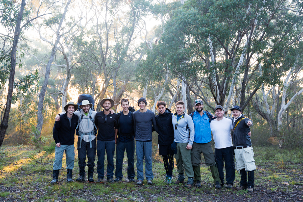
The crew before setting out: Daniel Bos, Daniel Frank, Richie Doff, Seb Ruiz, Shaun Greenblo, Jason Shein, Josh Biggs, Lee Leibowitz, Tal Bergman and Rick Munitz
We rise at the crack of dawn, don backpacks and set off. Just a few steps in, bulky packs bear down and cause doubts … did Shaun really need to bring that gourmet Indian chicken curry for dinner, did Jason really need an espresso coffee plunger or did we really need to travel with four pro DSLRs among us!? Questions of weight and pack efficiency are quickly swept away by the flowing Wog Wog Creek, which demands that we unstrap gaiters and step out of freshly laced hiking boots to make it across dry. Except Lee, who, shoes and all, wades across unfazed by a splash of water, in the same determined manner that he would later bring to forming new trails in unchartered territory, under the navigational guidance of captain Tal and his first lieutenant Franky, of course. The rest of us are a lot more precious.


As the sun edges up further, it gives way to a morning of spectacular weather, showing off the Budawang region in all its elemental beauty. We make swift time travelling the picturesque countryside around Corang Peak and reach Corang Arch where we break for lunch, which tastes so much better than it ever could anywhere else. A plain sandwich or piece of fruit in this environment, after this level of exertion, is better than any meal at any award-winning restaurant in any city. Some of the crew explore the impressive arch-shaped rock formation that forces of erosion, probably some determined stream, managed to hollow out over an epic period of time. Others choose to conserve energy and sit back and relax; a wise decision in light of the significant distances and tumultuous weather that lie ahead.


Descending the rocky Corang Arch to the valley floor brings us to the junction point for our path home the next day. For now, we take the trail east towards the camping caves at the base of Mount Cole. Crossing the plateau presents another opportunity for our photographers to capture the lighthearted mood of the group surrounded by tall swaying grass. For a perspective of vastness, one of the photos show us as mere specks in this giant field in an endless landscape.


We push on, passing by Mt Bibbenluke and by this stage the compounding effects of distance and the burden of Tal’s pack begin to chip away at his energy levels but not his resolve. “Next time, I’ll be fitter” he promises himself. To add to his sense of fatigue, ominous clouds, claps of thunder and flashes of lightening stare us down from the horizon and within minutes are upon us. The storm invigorates some and unsettles others. The power of Mother Nature in all her glory. Waterproof clothing proves a reliable defence but in the Australian climate (unlike colder alpine regions) the breathability of Gortex (or similar) is always a double-edged sword as sweat builds up from within.
With only four kilometres to our intended destination, we reach an unexpected fork in the trail and neither left nor right provides any sign of being the correct way forward. It’s 50:50 odds. Leftwards we go but before long we are waist-deep in a tangle of plants with thorns as sharp and penetrating as the hawks’ talons that were hovering above earlier in the day. We backtrack and return to the fork and a couple of our crew scout out the area seeking a path. While we wait, comic relief as someone lets one rip, but the fumes are trapped by his waterproof coat and chimney their way up and out past his head, burning his eyes and providing immediate karma.
We follow the scouts in the right direction and time passes in relative quiet save for our footsteps plodding through muddy trails and the steady stream of rain ricocheting off synthetic jackets. At last we arrive at the foot of Mt Cole and after a short scramble enter its dry cavernous overhangs and organise camp. Despite the slightly sloping ground, our campsite is impressive and unique in that it is located directly behind a waterfall flowing off the top of Mt Cole. This cascading curtain provides an unlimited source of fresh water for drinking and cooking and its sound adds to the sense of tranquility of this setting. Soon enough, we are sitting around a warm fire, sipping whiskey and devouring hard-earned dinners, before realising that we, too, are being eaten for dinner by voracious leeches. We survey our bodies, some are unscathed but others and, one in particular, find leeches in some awkward crevices.


Some good old banter ensues around the fire until sleep finally summons with the crew retreating to tents, some sloping more than others.
* * * * * * *
A new dawn. Weary bodies congregate around the fire pit and stoke remnant embers back to life. Its warmth energises and its flickering flames mesmerise drowsy eyes, but we cannot delay departure if we are to cover 30 kilometres today. WTF? Just 30 kilometres after only 25 kilometres the day before. Aching bodies. Really!? HTFU. At this juncture, explanation of bushwalking distance is warranted. Thirty kilometres in this terrain with pack weights of about 20 kilograms is simply not equivalent to 30 kilometres elsewhere. Is it harder by a factor of two or more times? Yes, very possibly; but irrespective of the precise factor, it is undeniably tougher and requires a different type of fitness, even to its cousin of long-distance running. (Note: this does not apply to Shaun, who missed his calling as an Olympic athlete).
Before we strike camp with a ‘leave no trace’ philosophy, Seb assumes the role of medic and tends to those with injuries, in particular Jason’s swollen ankle, which looks like a genetically modified grapefruit. With all restored and packed, we bid our camping cave farewell, grateful for its sheltered embrace.


Today brings with it an appreciation of what is in store for the return leg, or at least part of it. But with ambition becoming the catchcry of this adventure, we are determined to live up to its calling, alas except for climbing nearby Mt Owen, much to Bos’s dismay! We retrace our slippery steps, beat the same peaks and troughs and pass through grassy plains, until we return to the base of Corang Arch. The morning showers have been replaced by blue skies and the group is in good spirits. We stop to study the maps and decide on an alternative route home, heading north to intersect Corang River and then west through an area devoid of markings and trails. We were about to become well-acquainted with ‘bush-bashing’ and have our navigational skills tested.
Just before embarking on this new segment, Franky recalls that he’s brought Anzac Day badges for everyone and despite being a day late, we hold a minute of silence for our national remembrance day. With badges pinned to our shirts we set off across the valley floor. Rolling hills surround us and the route forward is not clear, but before long we register that we are walking on fresh marshland formed by the overflowing Canowrie Creek. The narrow creek’s core cuts through the heart of the hills, drawing us deeper into the wilderness. From here, a semblance of a trail sporadically shows itself but then vanishes, permanently.
Navigation proves confusing as there are no obvious landmarks; no prominent peaks from which to triangulate position and travel alongside the river at all times is fraught with risk because of dangerous impassable terrain. And, unforgivably, we had forgotten a compass; we have an espresso coffee plunger, a solar powered coffee grinder and beans that have been squeezed from the alimentary canal of a South American Jacu Bird, but no bloody compass! Did we refer to some of us as semi-experienced bushwalkers? I think not. This is a rookie error that only one of us had a right to make, namely Josh, since this is his first time out bush. And while he would not have been out of line to have thought “what the fuck are these guys doing!?”, I think he was actually relishing the sudden heightened sense of adventure and the challenge of not having to spend another night out here.
Josh’s hypothetical thoughts aside, the scenery is strikingly beautiful – plants and shrubs exhibiting every shade of green scattered among grey and white boulders and the whole scene punctuated by skeletal trees scorched by recent wildfire. Depending on your perspective, we were either wandering about a real-life quintessential Australian oil painting or through an apocalyptic scene from the bible. I prefer the former, but for the sake of analogy, let us proceed with the biblical scenario of desolation, in which case Tal is Moses, our global positioning shepherd, who, with input from Franky and Lee’s bush-bashing bulldozing power, will lead his tribe to safety.
Meanwhile and back to the 21st century, Bos, Rick and Seb are staring down the viewfinders of their bulky cameras intent on capturing the day from a dizzying array of perspectives, made possible by heavy glassware swinging clumsily about their necks. Suddenly, the raging Corang River appears in one of their lenses in perfect rule-of-thirds composition. The plight of Tal’s people is completely lost on these three photographers, but the rest of the crew realise that the only way out from here is up the steep shark fins ridge we’d been avoiding up until now.


From this point onwards, the day and inevitably night continues in much the same way. We break trail and seek out a path of least resistance, often wading through thick head-high plants in this untouched countryside, returning to the river as the ultimate landmark and guide when it is safe to do so. Just before our final turn away from the river, we come across a section that is calm and inviting but frigid and only Lee, Richie and Shaun dare enter while the rest of us take the time to recover. We resume our hike, the sun sets and just as twilight is upon us we reconnect with the formed trail. Relief. There is still a long way to go before we reach Wog Wog, but navigation will be straightforward from here.
It is a day and weekend of backbreaking work but eternally rewarding on so many levels that only those who were there can truly understand. Thank you all.


Pingback: Bushwhacked in the Budawangs | GET OUT ADVENTURES