

Flying high above Rio
The 2014 FIFA World Cup is about to kick off in just two days’ time with Brazil and Croatia set to battle it out in the opening match. It’s had me thinking back to a South America trip some years ago where friends and I meandered south from Mexico and somehow made it all the way to Argentina. From these travels, Rio definitely stands out as a remarkable city and always reminds me of my first hang gliding experience (at Rio Tandem Fly). If I were there now for the World Cup, I’d have to (briefly) pull myself away from the energy and magnetism of the football in order to fly, once again, hundreds of metres high above this beautiful coastal city.
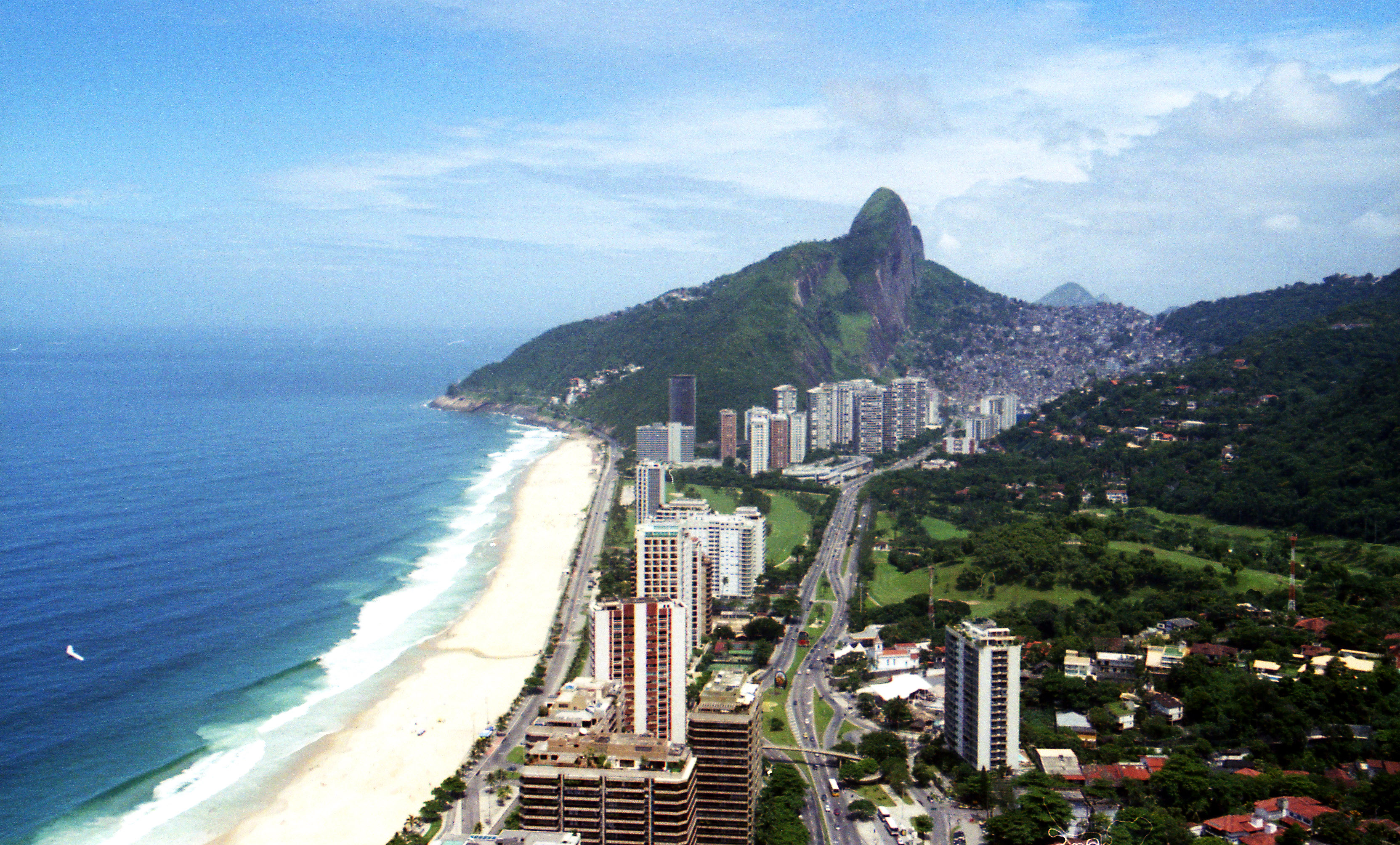
View from the air with the beach making the perfect landing strip


